RICS logo
 
    Boundary Mapping      

Who we are...

Home

About Us

Practice Profile

Consultancy

Contact

Projects

Links

Sitemap

Careers

Strategic Alliance


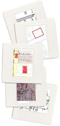
At mga, we adopt a detailed and systematic approach to understand and determine boundaries. This process starts with exhaustive site investigations, through to research of Title Deeds and all relevant information.

Once determined, we usually plot the boundary on a detailed GPS-linked site plan, adding if required, both our interpretation of the Legal Boundary (red line), plus a Build-ability line (blue). The latter enabling a developer to accurately calculate the amount of accommodation that can be achieved on a given site.

Key Points

  • Boundary Mapping seeks to maximize the site footprint, without trespassing over the land of Adjoining Owners.

  • Existing Buildings/Street Furniture often bear no relation to Legal Boundary.

  • Determined Boundary can be accurately linked to GPS.

  • Boundaries agreed with Adjoining Owners or their Surveyors.

  • Plans prepared and submitted to Land Registry for formal registration if required.

  • Ad Medium Filum (Viae/Aquae) - Calculation and Determination of presumptive rights under English Law.

mga offer pre-acquisition advice and reports on boundaries if required, please contact us for further information.

various snapshots: building plans and deed  

What we do...

Party Walls

Boundary Mapping

Rights Of Light

Acquisitions

Dilapidations

Refurbishment

Environmental


Pyramus & Thisbe Club logo  


MGA 1 Bramber Court Bramber Road London W14 9PW
T:020 7385 2051 E:apple@mg-a.co.uk
  Society For The Environment logo